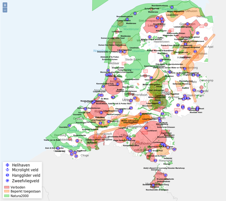
File:Overizchtskaart vliegen met drones.png
Jump to navigation
Jump to search


Size of this preview: 674 × 599 pixels. Other resolution: 868 × 772 pixels.
Original file (868 × 772 pixels, file size: 410 KB, MIME type: image/png)
File history
Click on a date/time to view the file as it appeared at that time.
| Date/Time | Thumbnail | Dimensions | User | Comment | |
|---|---|---|---|---|---|
| current | 18:44, 11 February 2019 |  | 868 × 772 (410 KB) | N.p.m.v.d.waterlaat@student.tue.nl (talk | contribs) |
You cannot overwrite this file.
File usage
The following file is a duplicate of this file (more details):
There are no pages that use this file.