File:Bathymetry.jpg
Jump to navigation
Jump to search

No higher resolution available.
Bathymetry.jpg (750 × 563 pixels, file size: 242 KB, MIME type: image/jpeg)
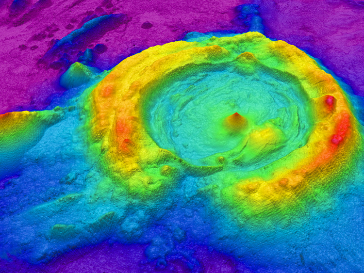
Map of a huge caldera in the NE Lau Basin, created from multibeam data processed with GIS software. (source: http://oceanexplorer.noaa.gov/technology/tools/mapping/mapping.html)
File history
Click on a date/time to view the file as it appeared at that time.
| Date/Time | Thumbnail | Dimensions | User | Comment | |
|---|---|---|---|---|---|
| current | 15:50, 28 April 2016 | | 750 × 563 (242 KB) | S140120 (talk | contribs) | Map of a huge caldera in the NE Lau Basin, created from multibeam data processed with GIS software. (source: http://oceanexplorer.noaa.gov/technology/tools/mapping/mapping.html) |
You cannot overwrite this file.
File usage
The following page uses this file: